
The San Luis ZIP Coverage
The verified San Luis ZIP code is 85349. It serves the Arizona city and nearby postal-delivery territory. The San Luis Post Office confirms a standard street-delivery and PO-box ZIP, not a PO-box-only or unique institutional ZIP. A postal city name says where mail is routed. It does not prove that every delivery point lies within San Luis corporate limits.
| ZIP | Delivery area | Postal facility | Key limit |
|---|---|---|---|
| 85349 | San Luis city and nearby postal area | San Luis Post Office, 874 S. Main Street | Postal city is not proof of incorporation |
The research did not verify an exportable USPS boundary table or a second official ZIP for San Luis. Peripheral delivery points must be checked one address at a time. This keeps the ZIP code directory tied to official evidence rather than a third-party boundary shape.
The official USPS facility record shows the main San Luis postal details.
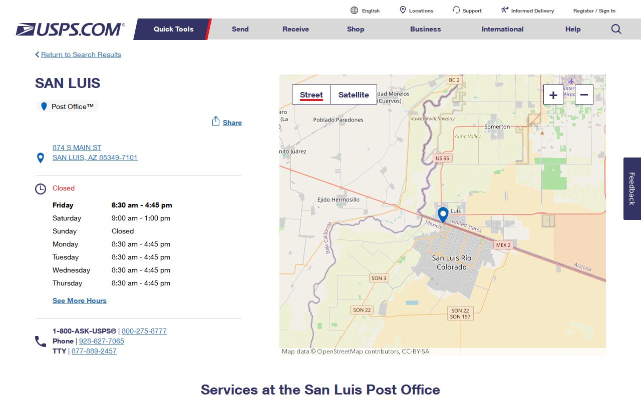
The capture anchors 85349 to the local facility while leaving city-limit questions to jurisdiction maps and parcel records.
Verify San Luis ZIP with USPS
Use the official USPS city and state ZIP lookup when the query begins with “San Luis, AZ.” Use the exact-address mode when a street number is known. The city-and-state result finds postal codes tied to a mailing name, while the address result tests the actual delivery format. That distinction matters near city edges and in new subdivisions.
The USPS city-and-state search screen is the first of two official postal tools used for the San Luis search.
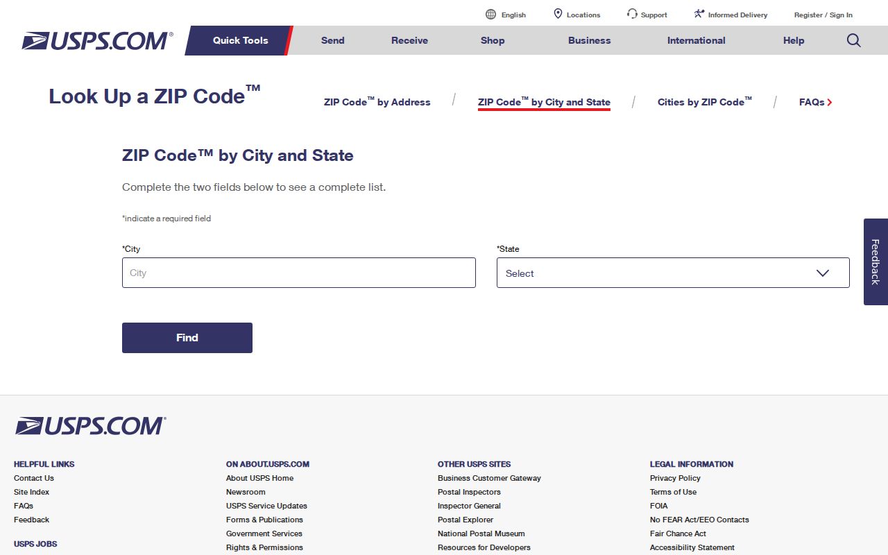
The form confirms postal assignment. It does not list residents, owners, parcel boundaries, or incorporated territory.
USPS also publishes ZIP lookup guidance for its address tools.
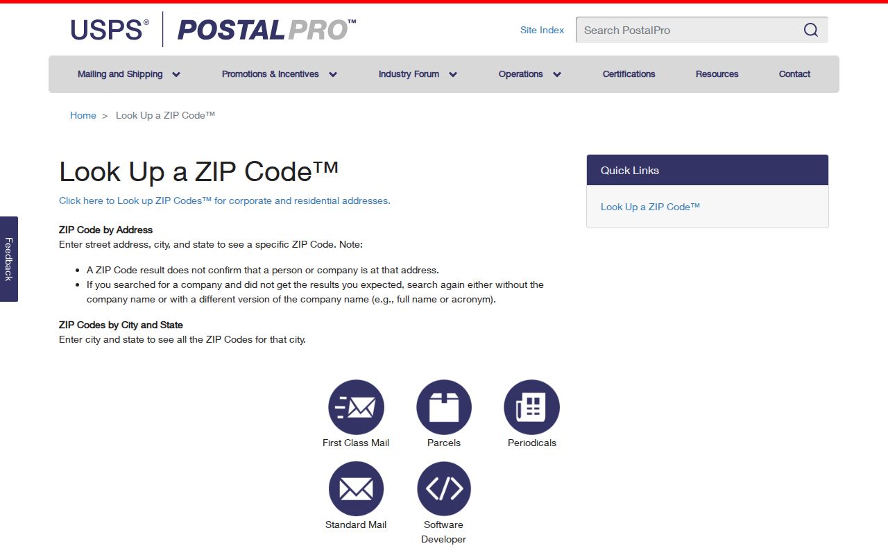
Together, the two USPS sources support a careful order: check the delivery city and ZIP, validate the exact address, then move to Yuma County records for the parcel.
San Luis ZIP Search Fields
The Yuma County Assessor EagleWeb has Basic and Advanced account searches. Advanced controls include City/Zip along with owner, business, situs, parcel, subdivision, legal, value, and acreage fields. Each field is optional, but one strong key often works better than a form filled with guesses. The county's stated search advice is “less is more.”
| Field | Use in a ZIP search | Format clue | Caution |
|---|---|---|---|
| City/Zip | Narrow candidate account results | Enter the verified postal value | Not a complete resident roll |
| Situs address | Locate the physical parcel | House, direction, street, type, unit | Different from mailing address |
| Owner name | Cross-check a known person or entity | Last Name First Name | Owner may not occupy the site |
| Parcel number | Retrieve one known parcel | Portal example omits dashes | Use the exact county value |
| Subdivision and lot | Bridge street-format changes | Platted legal fields | Not a postal boundary |
A research test using City/Zip 85349 returned only 14 results. That result proves the control can return matching accounts, but it does not prove full ZIP coverage. Do not publish it as the number of parcels or residents in 85349.
An EagleWeb parcel card may show account and parcel numbers, situs and mailing addresses, legal description, subdivision and lot, land use, values, and transfer links. Those fields help test whether a ZIP result belongs to the right land. Residential class codes can suggest owner or family occupancy, but they remain assessment labels. Even a matching mailing and situs address does not name each member of a San Luis household.
Find San Luis Residents by ZIP
A ZIP code is a broad filter. The Assessor identifies taxable property owners and parcel data, while Yuma County GIS supplies map context. Neither system identifies all renters or household members. Arizona's voter status portal is an identity-gated self-service tool, not an open ZIP resident list. A request for voter files must fit the purposes and limits in A.R.S. §16-168.
- Verify the postal city and ZIP through USPS, using the exact street address when possible.
- Open EagleWeb as a free public user and test City/Zip with one other reliable field.
- Inspect the account's situs address, mailing address, APN, and legal description separately.
- Use county GIS to check the parcel and jurisdiction rather than assuming the postal name matches the city line.
- When the work narrows to one road, continue with the San Luis street directory workflow.
The resulting chain moves from delivery geography to property geography. It may support an owner-and-address match, yet it still does not establish every person who lives on the parcel.
The San Luis ZIP Typo
One library webpage renders 85336, while the official USPS facility and delivery material verify 85349 for San Luis. Without an exact-address USPS result supporting another code, treat 85336 as a site typo. A copied digit can spread quickly through local pages and search results, which is why the postal source sits above a secondary location page in the evidence chain.
The San Luis Library location page is still useful for the branch itself and for reaching local history services.
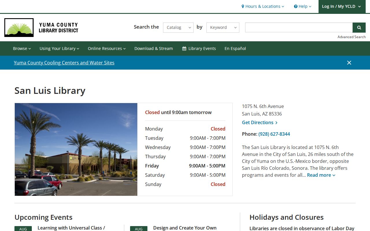
The image belongs in the comparison because it shows the source where the conflicting text appears. USPS controls the ZIP decision; the library remains the source for its own address and services.
Note: When two official-looking pages conflict, the agency that owns the data controls the answer, and exact-address verification is the safest check.
San Luis ZIP Versus City Limits
ZIP boundaries are designed for mail delivery. City limits define municipal jurisdiction. Parcel and subdivision lines describe land. Those systems can overlap without matching. An address may use “San Luis” for delivery yet fall outside the incorporated boundary, and a new annexation or subdivision can enter city records before an older directory or map reflects it.
San Luis sits opposite San Luis Río Colorado, Sonora. Add Arizona and Yuma County to searches so a postal result is not confused with the Mexican city. For the local parcel, keep the APN and legal description. The Assessor's situs address states the physical tax location, while the owner mailing address is only where notices go.
Concrete address changes make that practice worthwhile. A 2004 city resolution renamed a street to Urtusuastegui. In 2017, San Luis adopted a roadway naming and addressing policy and changed First Avenue to William Brooks Avenue. An APN, subdivision lot, or section-township-range description can bridge old and new street wording.
The international border, canals, agricultural parcels, and annexation-era growth can also break assumptions based on consecutive house numbers. GIS shows spatial relationships more reliably than a numbered-address list. Search or click the parcel, save its APN, and inspect the jurisdiction context available in the current viewer. Then return to USPS if the question is mail delivery. The map and the postal tool answer different parts of the same San Luis address problem.
San Luis ZIP Address Terms
Postal, county, and map systems use different units. Knowing which one answers the question prevents a postal directory from being mistaken for a household list.
- ZIP code
- A five-digit USPS routing area. It is not a city boundary.
- ZIP+4
- A five-digit ZIP plus four digits that narrow delivery to a segment, building, or box group.
- PO-box ZIP
- A ZIP used only for post office boxes. San Luis 85349 is not PO-box-only.
- Unique ZIP
- A code assigned to one high-volume organization. No unique San Luis ZIP was verified.
- Carrier route
- A mail-delivery path inside a ZIP, not a list of residents.
- Situs address
- The physical tax location of a parcel, which may differ from the owner's mailing destination.
A legal description sits outside those postal terms. It describes the land by subdivision, lot, block, or survey system and can remain useful when delivery text changes.
Growth Within San Luis 85349
San Luis grew from 35,257 residents in the 2020 census to an estimated 42,030 on July 1, 2025. That is an estimated 18.5 percent rise from the 2020 base. The city had 34.03 square miles of land and 1,036.2 people per square mile in 2020. Fast growth helps explain why a historic directory or old map cannot stand in for the present ZIP code directory.
Household facts also shape the search. Census QuickFacts reports 9,562 households and 3.41 people per household for the 2020-2024 period, while 68.4 percent of occupied units were owner-occupied. An owner-only parcel roll therefore misses many people. New subdivisions also create street and parcel records that do not exist in the digitized 1948-1963 city-directory run.
Language and movement affect matching as well. QuickFacts reports that 90.9 percent spoke a language other than English at home and 87.4 percent lived in the same house as one year earlier. Search compound surnames with both parts, try accented and unaccented forms, and keep the postal address separate from proof of identity. A shared ZIP and surname are not enough to merge two people into one record.
The 2025 Los Agaves by Riedel Unit 3 plat shows how current growth is recorded: 95 lots across 20.3727 acres, tied to a section, township, range, and subdivision. That legal geography is more durable than a ZIP-wide name search. For any disputed address, use USPS for delivery, GIS for city and parcel context, and the Assessor for the current property account.