
Walk the San Luis Street Directory
A sound by-street search moves from the physical address to records with firmer identifiers. Start with the spelling used on mail, but do not stay tied to it. The Yuma County Assessor links the situs, or physical tax location, to a parcel number and legal description. GIS then places that parcel on the block. Recorded instruments reveal transfers, while city files and old directories add use and household clues.
Work in this order so each result supplies the next search key:
- Standardize the San Luis address, including its direction and street type. Search the Yuma County Assessor and save the account, APN, situs, owner mailing destination, and legal description.
- Open Yuma County GIS. Locate the same parcel, confirm its shape, and inspect parcels along the named street instead of assuming consecutive numbers touch.
- Use the owner name and linked instrument number in the Recorder index. Search both grantee and grantor roles to identify the purchase and earlier transfers.
- Use voter material only through a permitted Arizona purpose and the Recorder's controlled process. My.Arizona.Vote cannot produce a public street roll.
- Request San Luis permit, inspection, zoning, or code records by address, APN, case number, and a useful date range when the web has no complete public index.
- For a past household, browse county criss-cross directories and newspapers by address and name, then corroborate that dated snapshot.
The chain distinguishes a present tax owner from someone who lives there. It also creates durable citations. Record the query spelling, date searched, APN, instrument number, and office contacted.
Search San Luis Property Addresses
Yuma County Assessor EagleWeb is the main property search behind the modern address index. Public User Login gives free guest access. Account Search has Basic and Advanced modes, and the county's practical advice is to use less data first. A last name with a street can outperform a fully completed form. The portal separates professional accounts from ordinary public access.
| Search control | Best street use | Format note |
|---|---|---|
| Owner Name | Confirm a name already tied to the block | Try last name first, partial, and reversed forms |
| Situs Address | Find one place or a street segment | Separate number, direction, street, type, and unit |
| Parcel Number | Return to an exact parcel | Portal example uses digits and a letter without dashes |
| City / ZIP | Narrow broader results | Do not treat a small result set as a full city roll |
| Platted Legal | Bridge an old or changed address | Search subdivision, lot, block, tract, or unit |
| PLSS / Tract Legal | Find land outside a simple street form | Uses section, township, range, and divisions |
The official Assessor search screen shows the guest entry used for owner, address, and parcel work.
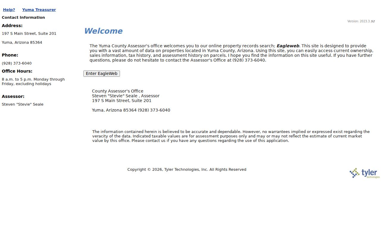
That screen is the starting point, not the answer by itself. Open the parcel card and compare the situs, mailing destination, legal land description, classification, and transfer link.
Note: A City or ZIP filter that returns few parcels does not prove the rest of a San Luis street has no records.
Read San Luis Street Terms
Four terms keep a by-address search precise. They also prevent the most common error: turning a property clue into an unsupported claim about a household.
- Parcel
- A mapped unit of land with an assessor account and parcel number. It may contain a home, business, vacant land, or more than one structure.
- Situs address
- The physical or tax location of the parcel. It is not the same as the address where the owner receives mail.
- Plat
- A recorded land map that shows lots, blocks, streets, and survey detail within a subdivision.
- Criss-cross directory
- A directory arranged by street or telephone rather than only by surname, useful for finding an occupant snapshot at an older address.
An APN is strong for the current system, but it can change. San Luis research is safer when the file also keeps the subdivision, lot and block, or section-township-range description.
San Luis Street Record Layers
No one roll is a complete San Luis by-address list. The most useful sources overlap, yet each records a different legal or historical event. The table shows both the online path and the fallback channel when a portal stops.
| Address source | Custodian | Street evidence | Ways to reach it |
|---|---|---|---|
| Property roll | Yuma County Assessor | Owner, situs, mailing, APN, legal description, class | Free EagleWeb guest search; office products and records |
| Parcel map | Yuma County GIS | Parcel shape, adjoining land, roads, district context | Free interactive maps; Assessor record by APN |
| Recorded instruments | Yuma County Recorder | Deeds, liens, releases, plats, party roles | Online index; public counter; request by instrument or book/page |
| Permit and code files | San Luis Development Services | Project address, applicant, owner or contractor, dates | Department or City Clerk request; no complete index found |
| Voter register | Yuma County Recorder | Residence address only for a permitted statutory use | Controlled inspection or affidavit request; not a web street list |
| Directories and clippings | Arizona Memory Project and Arizona Room | Named people, businesses, phones, events, and some addresses | Digitized PDFs; microfilm; staff-assisted room research |
The property and GIS sources are current administrative evidence. Deeds prove transfers. Permits show who applied or worked on a project, not who slept at the address. Directories and newspapers are dated snapshots. Keep their roles separate.
Map San Luis Street Parcels
Yuma County GIS adds geometry that a text address list lacks. Search or zoom to the subject parcel, click its polygon, and save the APN from the pop-up. Pan along the road and click each parcel needed for the question. A parcel across an alley, canal, or broad road may look close in an address list but not share a boundary.
Use visible parcel, aerial, zoning, flood, jurisdiction, district, and road layers only when the live viewer offers them. Exact enabled layers can change. No verified public radius or buffer export was found, so a careful click-by-click inspection is more defensible than claiming the site can produce a full resident list.
The immediate-block method belongs on the San Luis neighbors page. For a whole named road, continue the street-by-street sequence here and keep each APN with its own record notes.
Link San Luis Streets to Deeds
The Yuma Recorded Documents portal is keyed chiefly by people and instruments, not by street. Carry the owner name, legal description, APN, and any linked Recorder number from the parcel card. Search that owner as grantee for an acquisition deed and as grantor for a later transfer. Save the instrument number, recording date, document type, party role, and book/page when present.
The exact first year of the live online index was not published. Older official material may require the Recorder counter, microfilm, or a request with a precise docket, page, or document number. Preservation work has involved historical documents from 1864 through 1993, while the project begun under an October 2023 agreement targets material dating to 1894 for eventual online access. Neither statement proves a current portal cutoff.
A deed names an ownership transfer. It does not prove that a grantor, grantee, trust, or lender lived on the parcel. A sound San Luis by-address result pairs the deed with a parcel and, where lawful, independent household evidence.
Bridge San Luis Road Changes
San Luis has real address-continuity events, but no verified citywide renumbering date. Resolution 576 changed a street name to Urtusuastegui on October 27, 2004. In 2017, Resolution 2016 adopted a Roadway Naming and Addressing Policy, and Resolution 2019 changed First Avenue to William Brooks Avenue. Search the city's resolution archive by number and year, then ask the Clerk for an exhibit if the scan omits the affected segment.
Legal land text is the bridge. A subdivision, lot and block, or section-township-range remains useful when a road name, suffix, postal style, or APN changes. Assessor modernization changed many county parcel identifiers around the early 2010s, which makes a legal description more durable than an APN alone.
Can an old street name still find the parcel? Often, but not by itself. Search both names, compare the legal description, and use the resolution date to explain why the same land appears under two address forms.
Request San Luis Address Files
San Luis building permits, inspections, zoning, code cases, maps, and related Development Services material can date changes at a property. No complete public case index with stated coverage was located. Lead with the fallback: send a focused request through the San Luis City Clerk records process or contact the responsible department.
Give the exact street address, APN, permit or case number if known, and a date range. Ask for an electronic copy when practical. Arizona Public Records Law calls for prompt access but sets no universal day count; volume, review, and redaction affect the response. A permit applicant or contractor is a link to a project, not automatic proof of residence.
Note: A focused address and date range helps the custodian locate San Luis records that cannot be browsed in a public portal.
San Luis Voter Street Limits
My.Arizona.Vote is an identity-gated self-service tool, not a public by-street directory. Arizona's official precinct register can contain a name, party preference, registration date, and residence address. Yet A.R.S. §16-168 limits individual voter files to specified political, election, redistricting, government, petition, news, or statistical uses. It bars commercial use and internet redistribution.
A lawful request goes through Yuma Voter Registration with the purpose affidavit and required identifying details. Public aggregate totals by precinct or district offer safe context without exposing a block roll. Protected registrations remain sealed, and withheld identifiers do not become public because another record names the same person.
The Arizona commercial-purpose provision is also part of the records-law boundary.
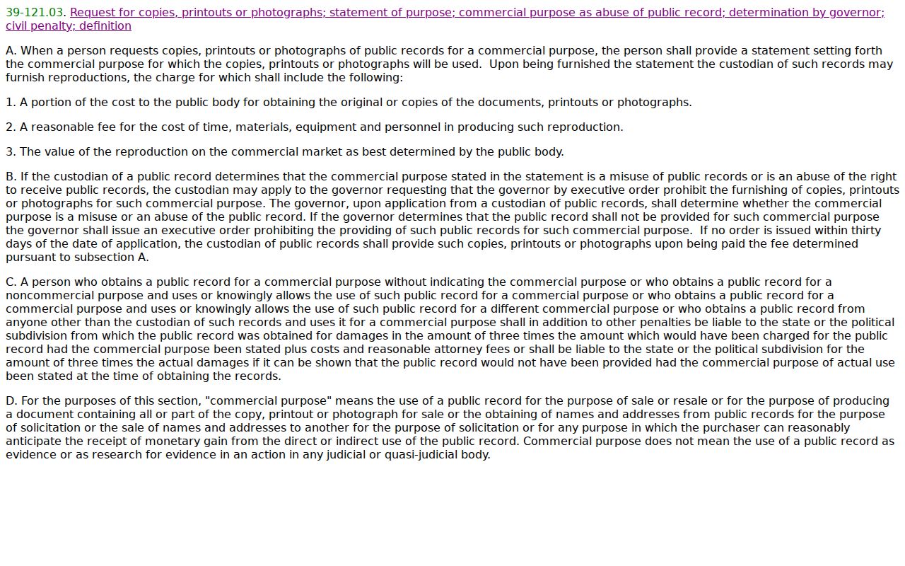
The statute screen reinforces a basic rule: access terms depend on the record and declared use, not on whether an address can be typed into a search box.
Browse Historic San Luis Streets
The Arizona Memory Project has fifteen verified Yuma City-County or Cosmopolitan directory volumes: 1948, 1949, and 1951 through 1963. Search the countywide alphabetical listings for San Luis names, then inspect a street or reverse section when one is present. Early entries may rely on a PO box, shortened community code, phone, or institution instead of a modern street address.
OCR can read San Luis as “San Luise.” Spanish compound surnames may lose an accent or second surname. Try each meaningful name part and browse nearby pages. The San Luis Directory Book gives the collection-level method; for a street search, copy only the address, household clues, volume year, and page needed to connect that snapshot to a parcel or later deed.
San Luis Street Directory Limits
A property owner is not always an occupant. The mailing address can lead to a trust, agent, business, or PO box, while renters and other household members usually do not appear on the tax card. GIS shows land, not relationships. Utility subscriber details, DMV addresses, protected voters, juvenile matters, sealed files, and Address Confidentiality Program locations may be closed or suppressed.
A by-address result should therefore be stated at the right level: “the parcel roll names an owner,” “the deed records a transfer,” or “the directory listed a household in that year.” Do not turn one dated index into a claim about who lives there now.
The Arizona Address Confidentiality Program provides a substitute address and confidential mail forwarding for eligible protected people. A missing location may therefore reflect a lawful safeguard.
Lawful use. San Luis address records support personal research, family history, property study, and civic inquiry. Never use them to stalk, harass, threaten, track, or harm anyone.